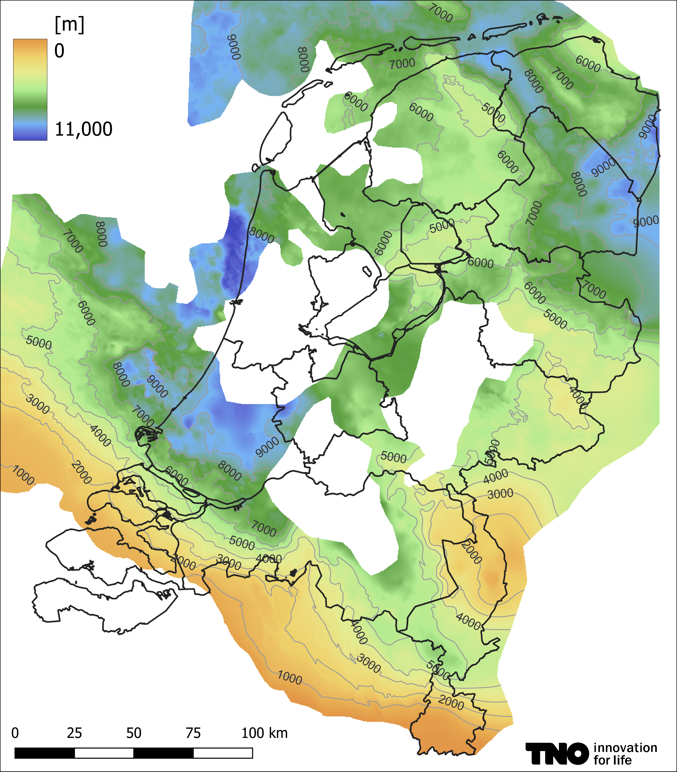
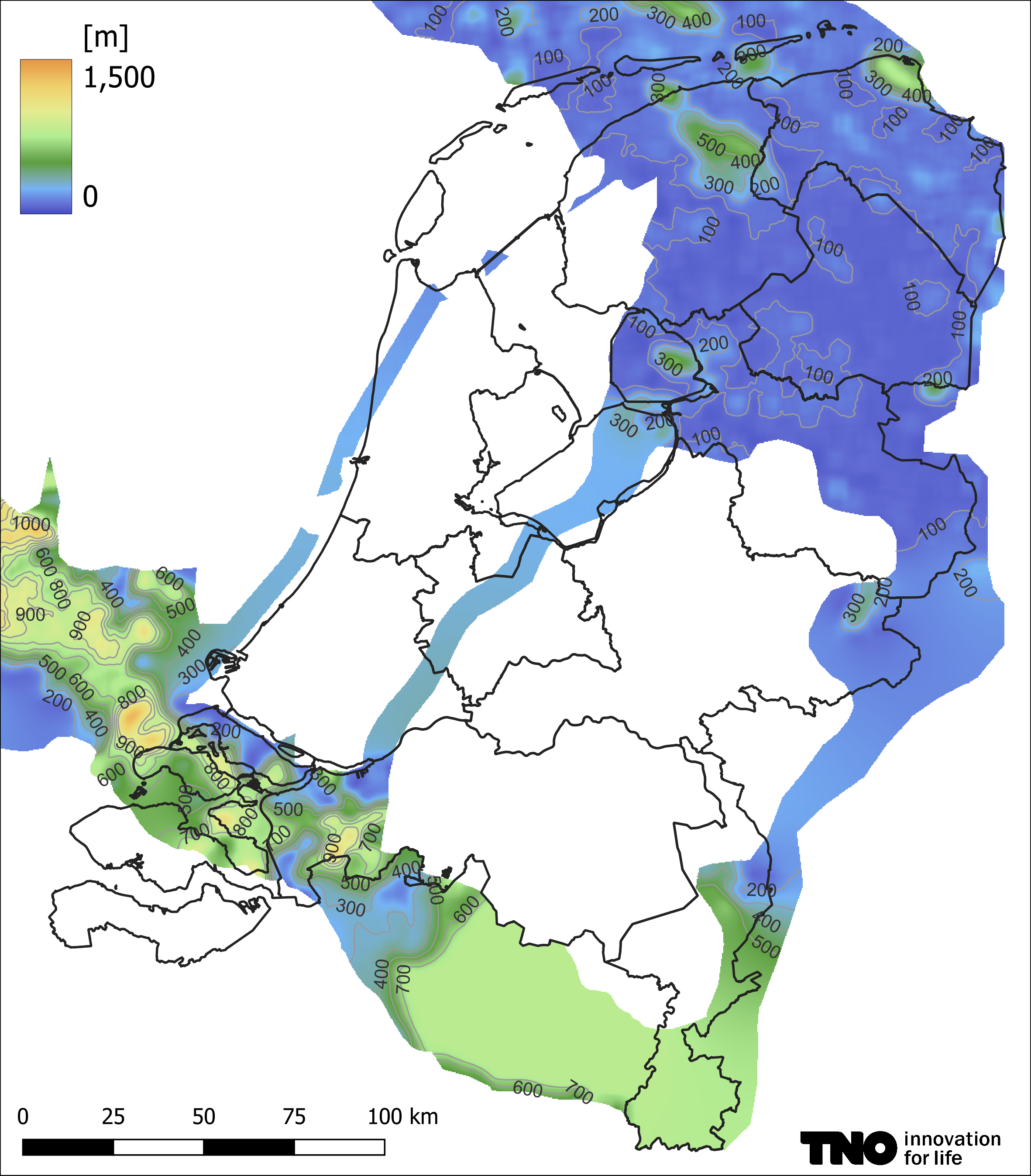
The deepest distinguished layer in DGM-Deep model is the base of the Limburg Group, the oldest part of the Upper Carboniferous. The carbonate rocks of the Lower Carboniferous below are known in the Netherlands by various names: Carboniferous Limestone Group, Zeeland Formation, 'Kolenkalk', Dinantian, or sometimes as 'Kulm'. They are potentially of interest for geothermal production in the southern and southeastern parts of the Netherlands, where they occur at depths of less than ~2500 metres. In the largest part of the Netherlands, however, they are buried to depths of more than 4000 metres, and therefore potentially interesting for ultra-deep geothermal ('UDG') production. By nature, the rocks are highly impermeable, but may have karst or fracture permeability. Because of its deep burial, which makes mapping by seismic and/or drilling challenging, and in particular the spatial distribution of permeability that is very different from that in clastic reservoirs, only the depth and thickness of the Dinantian have been included in ThermoGIS where they are seismically mappable (ten Veen et al. 2019).
The map of the top of the Dinantian in ThermoGIS was adopted from the SCAN project. In most of the Netherlands the Dinantian was interpreted on seismic data. In the southern part of Limburg, however, borehole data was used. Areas where the Dinantian rocks are buried too deeply for seismic imaging have been left white. However it may be assumed that the Dinantian rocks are present throughout the Netherlands, with the exception of Zeeuwsch-Vlaanderen and Walcheren.
The thickness of the Dinantian is often difficult to determine on seismic data. In the northern and north-eastern Netherlands, and the provinces Zeeland, North-Brabant and the northern part of Limburg (where two doublets were drilled near the town of Grubbenvorst), the base of the carbonates is visible on seismic data. Here, the thickness is based on seismic interpretation. The seismic velocity that was used to convert time-thickness to depth-thickness, is based on sonic logs (6.21 km/s).
The permeability of the rocks is determined by karst and faulting and therefore has a small spatial correlation. Because of this heterogeneity it is difficult to interpolate . It was therefore decided not to include a permeability map in ThermoGIS v2.2. This also impedes the calculation of the geothermal potential. A potentially useful method to calculate the geothermal potential of the Dinantian is given in the GeoERA HotLime 'Report on play and prospect evaluation'.
The depth and thickness of the Dinantian are currently now available in the Mapviewer, because the potential calculations are not possible. The pictures below show the depth op the top (left) and the thickness (right) of the Dinantian from the SCAN-project.


