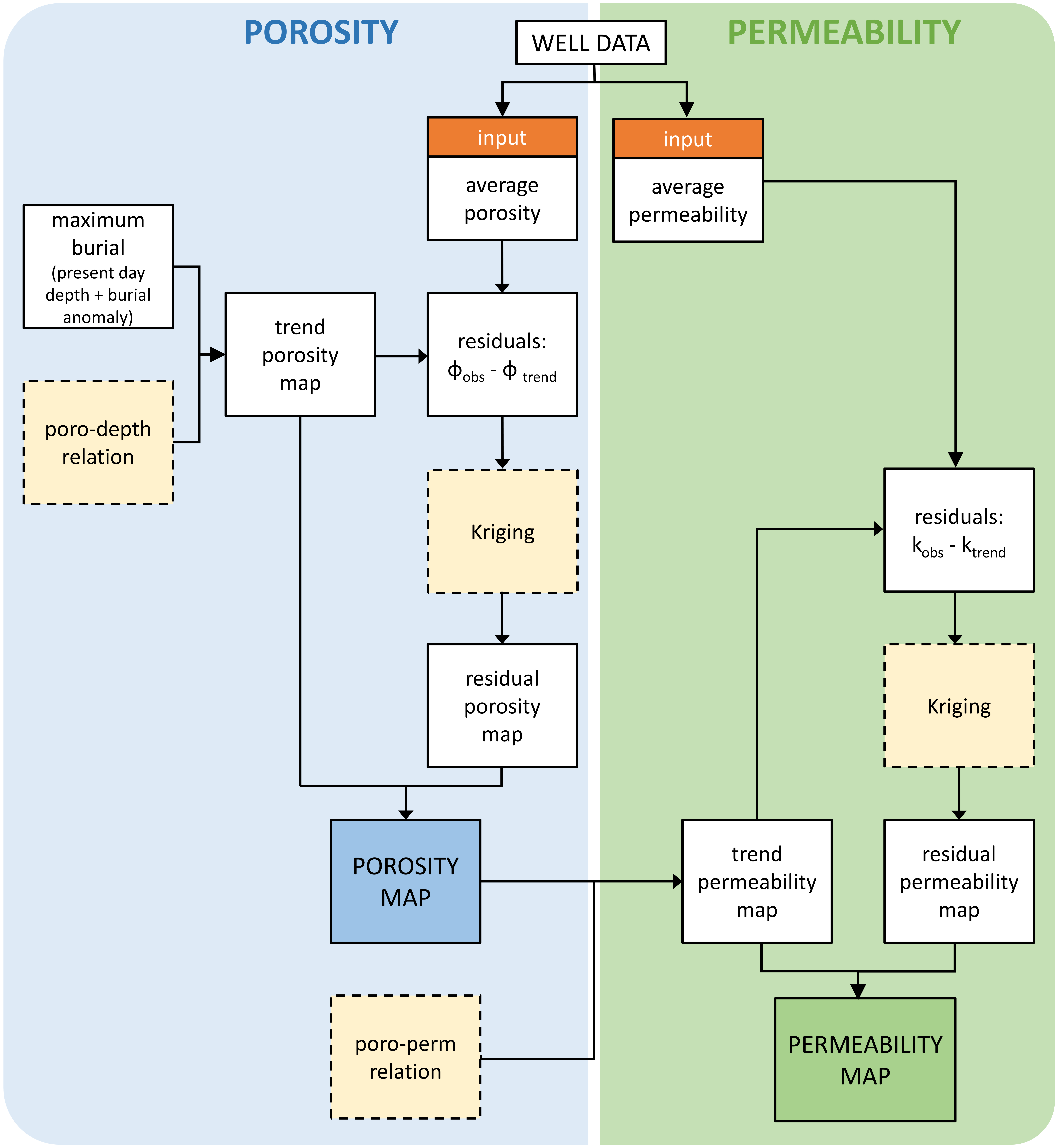
A proper estimate of the aquifer properties porosity, permeability and net to gross is a prerequisite for calculating geothermal potential. A generic workflow has been developed for calculating the aquifer properties maps.
Within the workflow, the porosity map of an aquifer is first created based on the available porosity data, a porosity-depth relationship and the maximum burial depth From this map, a permeability map is then derived. In addition, a net to gross map of an aquifer is interpolated.
Because the basis of the workflow is a simple porosity-depth-based trend map, it is universally applicable, even when little measured porosity data is available. However, the resulting maps are uncertain when the porosity-depth relationship and/or porosity-permeability relationship are difficult to determine due to lack of data. The latter applies especially to the Paleogene aquifers (with the exception of the Brussels Sand Member) and to the Nederweert Sandstone Formation, as well as to the 'Kolenkalk' (Dinantian).

